

|
|
Borden County Texas |
|
Photos copyright Charlene Beatty Beauchamp
BORDEN COUNTY
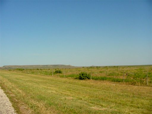
Borden County (D-10), at the edge of the Llano Estacado,qv
is bounded on the east by Scurry County, on the south by
Howard County, on the west by Dawson County, and on the
north by Lynn and Garza counties. The rolling, broken land
of the county drains to the Colorado River and its tributaries
and to Lake J. B. Thomas. The Caprock,qv
Gail Mountain, and Muchakooga Peak are notable physical
features. The soils are loams, sandy loams, and clay. The
county center is at 32°45' north latitude and 101°25'
west longitude, seventy miles southeast of Lubbock. The
county comprises 907 square miles at 2,400-3,000 feet elevation.
The annual rainfall is 18.2 inches. The average minimum
temperature in January is 32° F; the maximum in July
is 96°. The 214-day growing season produces an average
annual agricultural income of $12.5 million from beef cattle,
sheep, cotton, wheat, sorghums, and other grains. There
is no manufacturing, but 7,620,366 barrels of oil produced
in 1982 earned almost $245 million.
Comanches hunted buffalo in the region before white settlement. It was within the range of the Penateka band, also called the Honey-Eaters or Wasps, the largest and best-known Comanche band. The Penatekas led the advance into the southern plains in the eighteenth century after the people, a segment of the northern Shoshones, learned the use of Spanish horses and transformed themselves from impoverished root and plant gatherers to hunters. Settlers were not attracted to the area that is now Borden County until the end of the nineteenth century. It was too distant from the United States Army's frontier outposts to be safe even after the Civil War, qv and it seemed too dry to sustain ranching and farming. The county was marked off in 1876 from Bosque County and named for Gail Borden, Jr.,qv a newspaper publisher and organizer of the Republic of Texas, qv and a surveyor who helped lay out the site of Houston and prepared the first topographical map of Texas.
In 1876 ranchers from Howard County extended their range into Borden County. By 1880 there were thirty-five residents who, unlike most pioneers, resisted intrusions of railroads and other settlers who might disrupt their use of the open range. As late as 1890, only 222 people lived in the county on twenty-five farms and ranches; only 1,146 acres in the county were classified as "improved" by the United States census that year. At this time the local economy revolved completely around the cattle industry, and in 1890 over 71,000 cattle were counted in Borden. The county was organized in 1891, and Gail was made the county seat.
More farmers moved into the area between 1890 and 1910. In 1900, there were 129 ranches and farms in Borden County, and the population had increased to 776. A small boom occurred in 1902, when state school lands became available for leasing. New arrivals, mostly farmers, were not welcomed by the established ranchers, and many left. Nevertheless, by 1910 there were 228 farms and 1,386 residents in the county; thirty-six of the farms were worked by tenants. For the scattered population of the county, isolated rural life brought its own rewards. As young Mary Blankenship, qv who passed through the area in 1901 to settle with her husband somewhat to the north, reflected: "We had plenty of time to be still and know God. He was our nearest neighbor." The farms in the county dropped to 197 by 1920, but by 1930 the number had increased to 292 and the population was 1,505.
Many of the newcomers grew cotton, which by 1930 had become the county's most important crop. Cotton was first planted in the area during the 1890s; in 1900, it was grown on 137 acres of Borden County land. Cotton farming in 1910 comprised 2,206 acres, and in 1920, 3,820 acres; by 1929 more than 20,000 acres of county land was planted in cotton, while only 28,000 acres of cropland was harvested in the entire county.
The Great Depression qv of the 1930s put an end to the budding development of the county. By 1940 only about 12,000 acres of county land was planted in cotton, and only 233 farms remained in Borden; only 1,356 residents were counted that year. The discovery of considerable oilfields in 1949 did not arrest the decline of Borden County population, although it did provide fortunate ranchers and farmers with another source of income. Oil production in the county was more than 3,150,000 barrels in 1950, almost 9,819,000 barrels in 1960, and more than 10,876,000 barrels in 1974. Production decreased during the 1980s, however, and in 1990 amounted to only 5,679,658 barrels. By 1991, more than 340,003,000 barrels of petroleum had been taken out of Borden County since discovery in 1949.
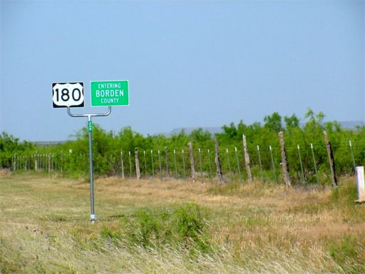
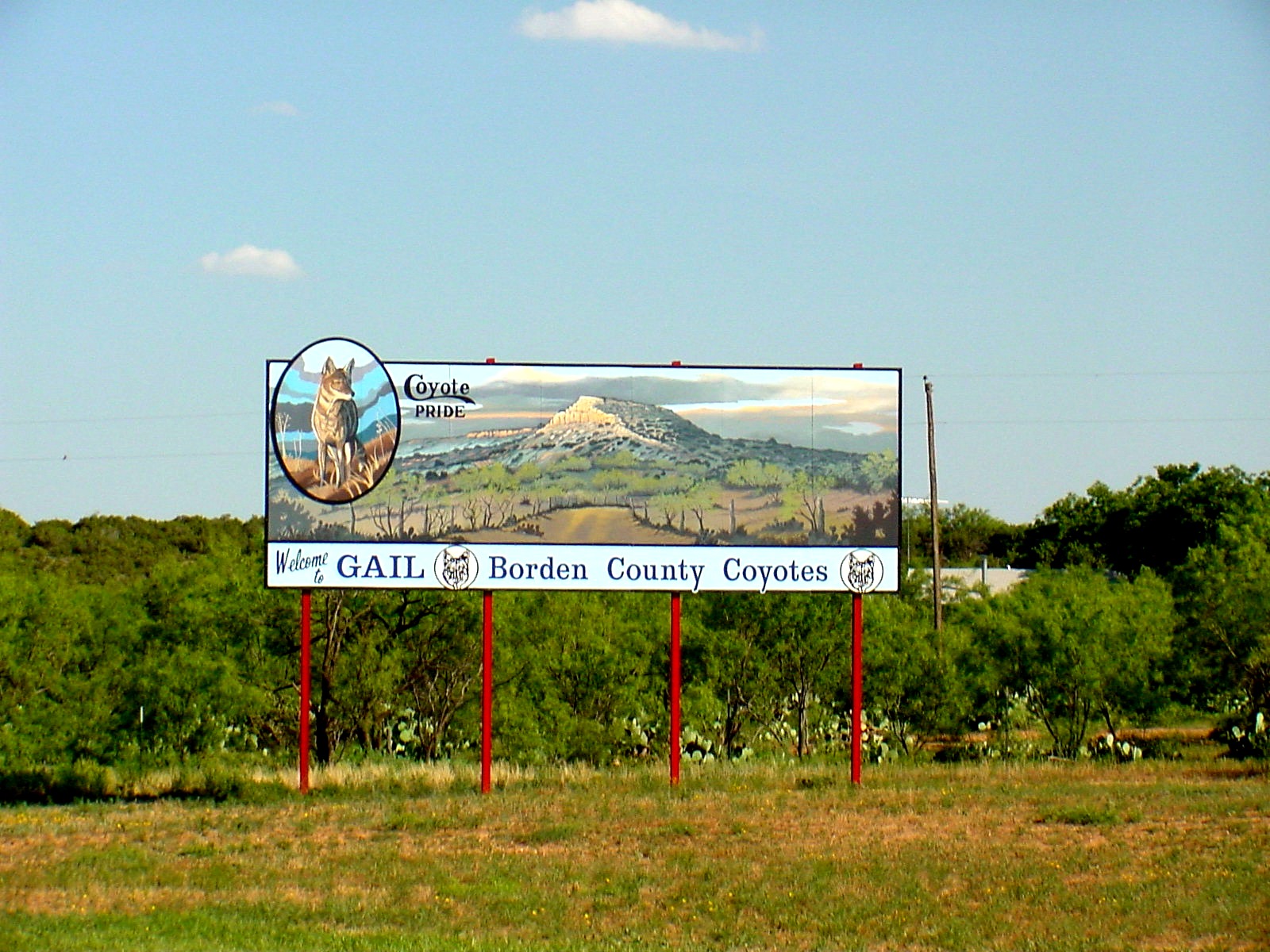
The population of the county continued to decline after World War II. qv Only 1,106 people lived in Borden County in 1950, and only 1,076 in 1960, 888 in 1970, 859 in 1980, and 799 in 1990. Tourists, mostly hunters and fishermen at Lake J. B. Thomas, qv contribute to the economy. Gail, the county seat and only town of note, had an estimated population of 202 in 1991. The highway system includes U.S. Highway 180 (west-east) and Farm Road 669 (north-south). William R. Hunt and John Leffler
Photos copyright Charlene Beatty Beauchamp
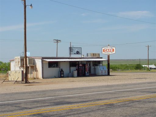
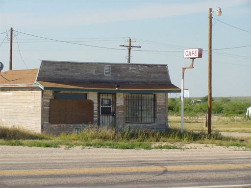
GAIL, TEXAS. Gail, on U.S. Highway 180 in central
Borden County, was named for Gail Borden, Jr., qv
when it was selected county seat in 1891. It experienced
a land boom in 1903 when five sections of state land were
sold. The War of Ribbons, in
which ranchers wore blue ribbons on their sleeves and
new settlers wore red, followed in 1903 without bloodshed,
and Gail and the county grew in population as farmers
took up land. Despite being a county seat,
the community remained small, and the county population
sparse. The estimated population in Gail in 1910 was 700,
and in 1912 it was 600. By 1936, because of the Great Depressionqv and changes
in agricultural patterns, Gail had declined to 250. In
1980 its population was only 189 in a total reported county
population of 859. Gail during the 1980s had a county
museum, a grade school, a high school, and a cafe. In
the early 1990s Gail was still the county seat and reported
a population of 202, served by eight businesses. BIBLIOGRAPHY:
Borden Star, Bicentennial Edition, May 19, 1976.
Lubbock Avalanche-Journal, August 17, 1985.
William R. Hunt
![]()
DURHAM, TEXAS. Durham was on Bull Creek ten miles southeast of what became Gail, three miles south of U.S. Highway 180, and two miles west of Farm Road 1610 in east central Borden County. Early members of the Durham community included the Waskom, Wicker, Calloway, Reeves, and Askin families. The first post office in Borden County was established in Durham on May 27, 1887, with Anthony Blum as postmaster. In the late 1800s Durham consisted of a trading post and stage stop on the Colorado City-Fort Sumner stage line. By 1910 the community had grown to include several houses and a general store, a church, and a school. A new school was built at Durham around 1911, but a severe drought in 1916 and 1917 resulted in the community's rapid decline. One store remained there for several years, but on October 25, 1925, the post office was discontinued and moved to Knapp in Scurry County. By the 1960s nothing remained at the site of Durham. BIBLIOGRAPHY: Borden County, Texas: The First One Hundred Years (Gail, Texas: Borden County Historical Commission, 1976). Charles G. Davis
From the page 29 of "
THE PERMIAN HISTORICAL ANNUAL ", Vol. VI December
1966 , published by PERMIAN HISTORICAL
SOCIETY , Mrs. Charles Miller Synder
(a Dorward's descendant born and reared on the 49 Ranch
in 1900 in Borden County) wrote:
"When the county organized in 1891, the first seat of
government was at DURHAM, a small community about 12 miles
northeast of GAIL, where we used to go for all - day preaching
and dinner - on - the - ground. This settlement including
the post office was named for I. E. DURHAM, who
took several sections of land in this area before the
County was formed." (1876)
For the full story contact the Permian Historical
Society at
http://permianhistoricalsociety.org/
She was the grand daughter of Maurice Doward
early pioneer rancher who operated the 49 ranch
later owned and operated by WOOD and ARNETTE. In 1899, her father, ED BILLS was
foreman of this ranch where she was born in winter of
1900 and he was killed by a horse in the spring of
1901. " Her uncles were Dave, Jim,
and Bob DORWARD."
![]()
MESQUITE, TEXAS (Borden
County). Mesquite is above the Caprockqv
on Farm Road 1054, sixteen miles northwest of Gail and
seven miles south of the Lynn county line in northwest
Borden County. A county rural school district was established
there around 1905 and served the area until the late 1920s
or early 1930s. Located in a relatively isolated area
apart from major highways, Mesquite remained a rural farming
settlement. Several scattered houses and an abandoned
schoolhouse were reported there in the 1970s and 1980s.
BIBLIOGRAPHY: Ed Ellsworth Bartholomew,
The Encyclopedia of Texas Ghost Towns (Fort Davis,
Texas, 1982). Borden County, Texas: The First One Hundred
Years (Gail, Texas: Borden County Historical Commission,
1976). Charles G. Davis
![]()
GRAPE CREEK, TEXAS
(Borden County). Grape Creek was seven miles southwest
of the site of what is now Gail in southwestern Borden
County. The settlement grew up around a school that was
established there about 1910. This school served the area
until it was consolidated with the school in Gail in the
early 1920s. Area residents included the Jackson,
Rogers, and Cranfill families.
BIBLIOGRAPHY: Borden County, Texas:
The First One Hundred Years (Gail, Texas: Borden County
Historical Commission, 1976).
![]()
TREDWAY, TEXAS. Tredway was a farming community established in northwestern Borden County in the vicinity of present Mesquite on a southern arm of the Caprockqv escarpment in the early 1900s. A post office existed there from 1906 to 1911; Albert M. Tredway was the initial postmaster. Two stores were operating in 1940, when the community reported a population of ten. County highway maps from the 1980s, however, show no evidence of Tredway.
BIBLIOGRAPHY: Ed Ellsworth Bartholomew, The Encyclopedia of Texas Ghost Towns (Fort Davis, Texas, 1982).
Charles G. Davis
![]()
Photos copyright Charlene Beatty Beauchamp
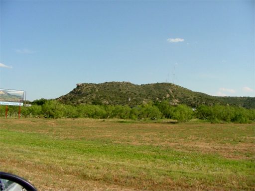
GAIL MOUNTAIN. Gail Mountain, also known as Gail
Peak, is just west of Gail in central Borden County (at
32°46' N, 101°27' W) and is probably named after
Gail Borden.qv The mountain
was possibly at one time called Mount Jake, after one
Jake Auger, a soldier who served with Ranald S. Mackenzieqv
in 1874. The peak, with a height of about 2,900 feet above
mean sea level, rises 342 feet above nearby Gail. The
local terrain consists of moderately steep slopes with
locally high relief, and the soils are erodible, shallow
to moderately deep silt loams that support mesquite and
grasses.
In E-mails to me, Kenneth
Bennett <bentb@poka.com > stated that
he had a 1874 army map that calls the GAIL MOUNTAIN - MONT
GUNTER.
I have never heard the other names mentioned that is in
your article". ( He is speaking of Mont JAKE and GAIL'S
PEAK.)
AN INVITATION:
" Stop by the court house and visit with us sometime . The
county judge lives in his great grandfather's house and
most of us have a long history here."
Kenneth Bennett, Borden County Treasurer & member of
Borden County Historical Commission.
Kenneth's Mother was
DORIS MELBA PEARCE Bennett ,
her father, LEE
ANDERSON PEARCE, traded some land on the Plains
near TREADWAY, to JIM
DORWARD for the section of land that most the mountain
lies on in 1924.
It has stayed in the family since and is currently owned
by DELMO PEARCE of Austin.
I lease the grass and run cattle on it."
Gail Mountain ( Pearce Ranch)
![]()
COMMANCHES of BORDEN COUNTY
AREA.
From the pen of one of Maurice Darword's grandsons
while doing his Graduate Thesis at S. M. U..
(Send to me by Kenneth
Bennett , Borden Co. Treasurer and grandson
of LEE ANDERSON PEARCE
and reared on GAIL MOUNTAIN.)
"THE DOCUMENTED EVIDENCE"
"The Comanche village at "MUCHA QUE" and its use as a COMANCHERO TRADING PLACE was first reported by captured CAMANCHERO POLONIO ORTIZ in his 1872 statement to MAJOR J. P. HATCH (HATCH to GRANGER, March 31, 1872.)
Through ORTIZ, the army learned that a band of COMANCHES, KNOWN AS QUAHADIES spent the winter of 1871/1872 in the MUCHA QUE area and that the village at MUCHA QUE SPRINGS served as headquarters for the exchange of Stolen cattle with the COMANCHROS.
At MUCHA QUE COMANCHES (QUAHADIES) and MESCALLERO APACHES from another village of over one hundred lodges, perhaps two hundred. They have many horses. The Chief was called PAH-WEEN or PA-CHA-CUNEE. As soon as our people arrived at MUCHA QUE , the Indians started a party of one hundred men to steal cattle. They left on March 19. A few Mexicans went with them. As soon as the cattle are bought to the village, the Mexicans will buy them and then return to New Mexico, but more will follow as it is regular business."
"According to ORTIZ , the Comancheros trade guns, ammunition, cloth, flour, bread, sugar, coffee and such for the cattle. The goods were supplied by a trader named ADOLPHE, who had a store in LA CUESTA, NEW MEXICO. (HATCH to AAQDT, April 15, 1872.)"
Kenneth Bennett <bentb@poka.com >, wrote "The above is the start of a nine page report. The young man was kind enough to leave me a copy, but it does not include his name. Someone at S. M. U. University may be able to locate it if it was published."
Copyright © 7/9/09 to present by
Norman
Newton
This
information may be used by individuals for their own personal use,
libraries and genealogical societies. Commercial use of this information
is strictly prohibited without prior written
permission
from
Norman
Newton
If material is copied, this copyright notice must appear with the
information and please email me and let me know.
Neither the Site Coordinators nor
the volunteers assume any responsibility for the information or material
given by the contributors or for errors of fact or judgment in material
that is published at this website.
Page
Modified:
10 January 2021