|
Black Ankle ~ ca 1890
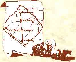
The Black Ankle community is located at
the junction of State Highway 80 and County Road 110 (now called Long Lane). The
road climbs a high hill and for miles in every direction is grassland and
mesquite trees. The area at one time was covered with hundreds of acres of
cotton farms, but today is primarily ranching country. In the eastern part of
the area, on the banks of the West Fork Creek, the Polk post office was
established in 1893. In the 1890s a church called High Point was established and
1912 records indicate a school named High Point was probably nearby. Traveling
south on CR 244 (now called Spoke Hollow) will intersect with the Old Fentress
Road and on either side, to present day FM 20, is the southern boundary of Black
Ankle. The name as recorded in Fred Tarpley's book "1001 Texas Place Names"
refers to the black heavy soil that clings to one's shoes after a heavy rain.
Source - Caldwell County Kin: The First
150 Years published by the Genealogical and Historical Society of Caldwell
County, November 2000
The Plum Creek Almanac is a project
of The Genealogical and Historical Society of Caldwell County.
 The Genealogical and Historical Society
of Caldwell County Copyright © 1963 The Genealogical and Historical Society
of Caldwell County Copyright © 1963
Updated
10/14/2019
|