 |
Live Oak County TXGenWeb Project |
 |
|
|
Live Oak County TXGenWeb Project |
|
Maps
|
The links to Texas maps below are offsite.
Some of the links to a Live Oak County map or plat are to jpeg files that are part of the Live Oak County site, and some of the links are off site. |
| Live Oak County Maps |
|
Oakville, Texas Land Platt
This platt can be located in Book K, Pages 638 & 639 in the |
|
1910 General Land Office Map |
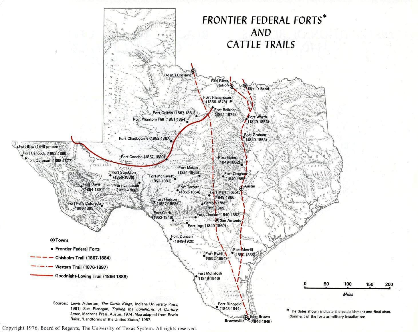
| Texas Maps |
|
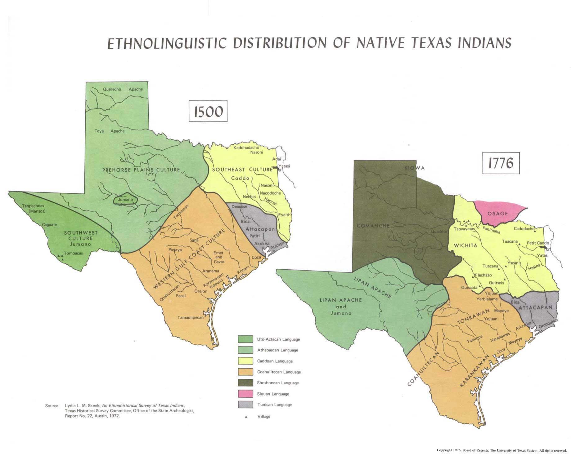
Distribution of Native Texas Indians in 1500 and 1776 |
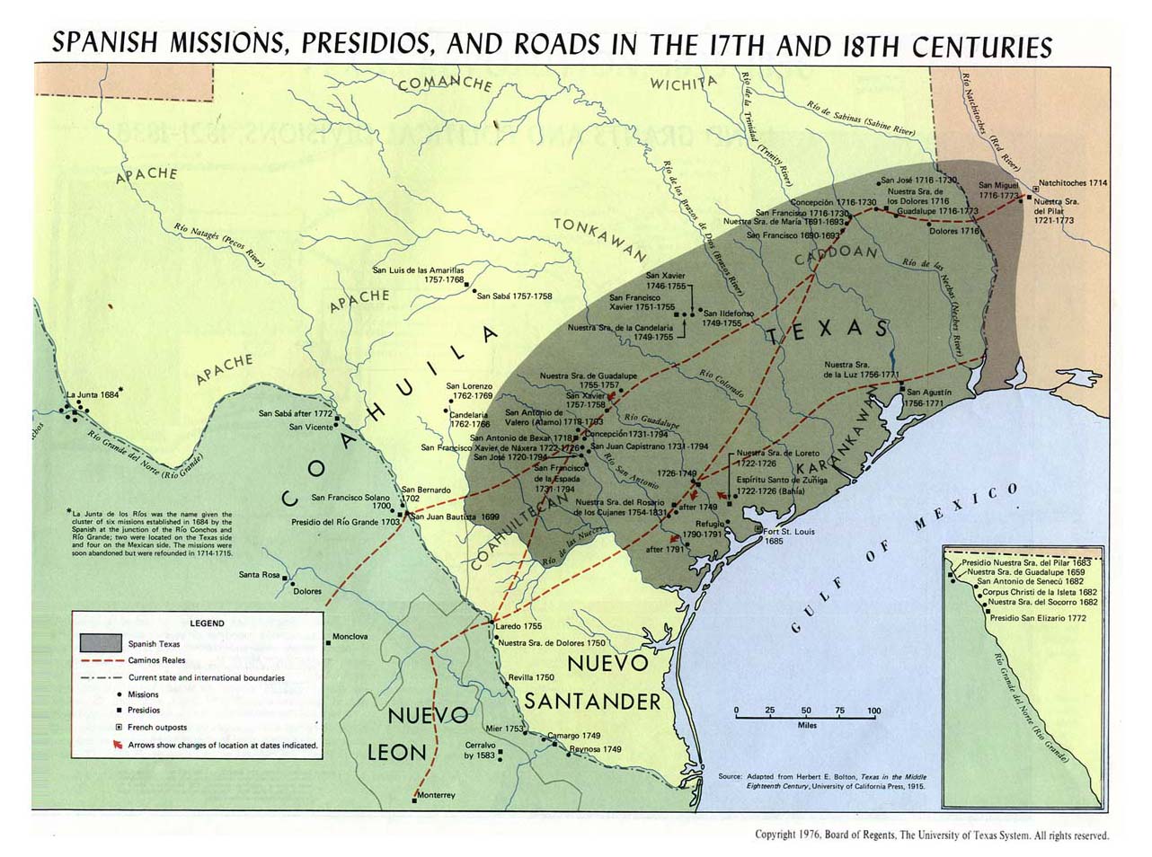
| Spanish Missions, Presidios, and Roads in the 17th & 18th Centuries |
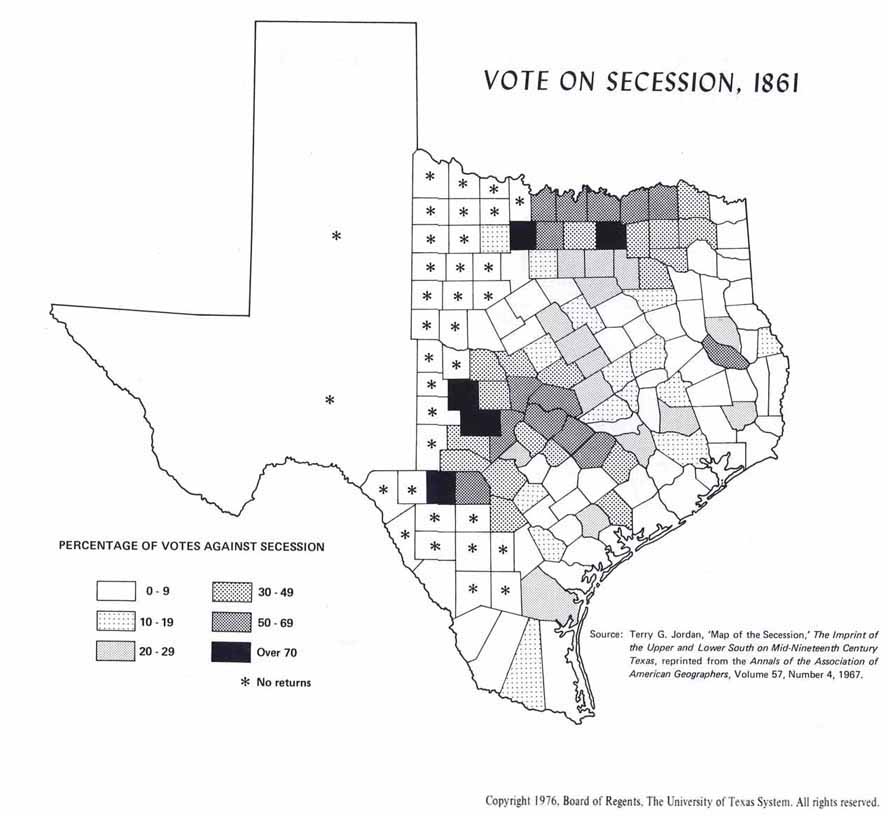
| Vote on Secession |
|
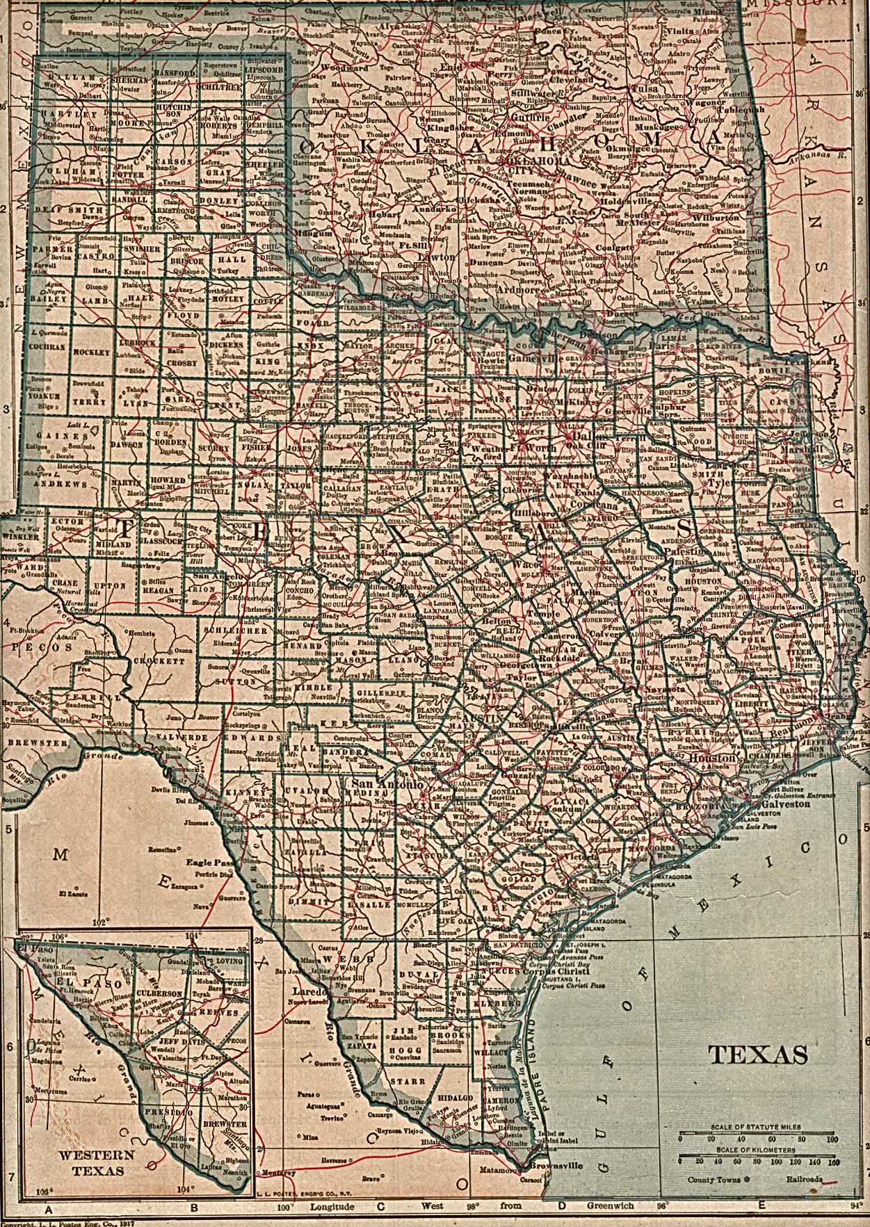
Texas 1917 |
|
|