


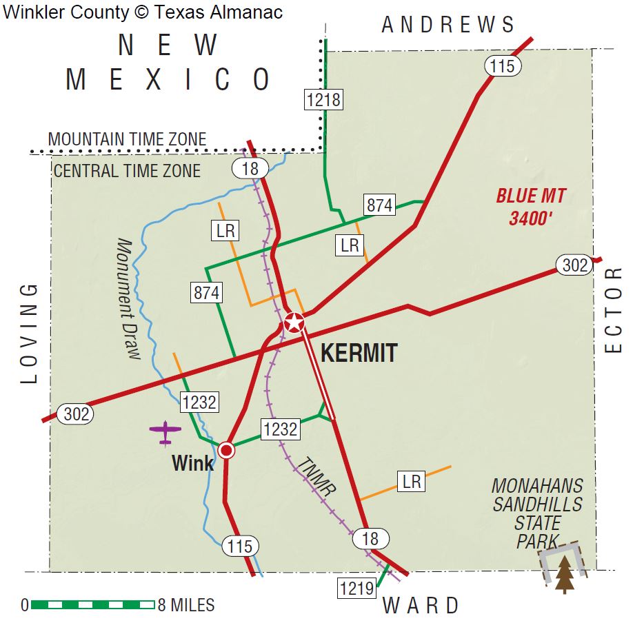
Winkler County
TSHA
USGenWeb >> TXGenWeb >> Winkler County >> >> Winkler County
Julia Cauble Smith
 |
|
Winkler
|
The first people to live in the area of Winkler County were the Anasazi Indians, who migrated there about 900 and left their discarded pottery as evidence of their presence. At some later time, the Apaches etched a trail across the county from Monument Springs in New Mexico to Shafter Lake in the area of present Andrews County. After the Apaches, the Comanche Indians moved into the White Sandhills and Blue Mountain areas of the county territory, using them as meeting places from the seventeenth century until the 1870s. These Native Americans were attracted to the area by its water, which was readily available from the interdunal ponds or from digging to the shallow water table. The first military expeditions entered the area of present Winkler County in the last half of the nineteenth century. Capt. Randolph B. Marcy brought his soldiers into the area on September 25, 1849, as he searched for the best wagon route to California. Bvt. Capt. John Pope surveyed the thirty-second parallel, which separates Winkler County from New Mexico, for possible railroad construction in 1854. On June 29, 1875, Col. William R. Shafter and eighty-one men and officers tracked Comanches into county lands, when Col. Ranald S. Mackenzie conducted a campaign to drive them from the area. By 1876 all threat of Comanche attack was eliminated, and the area of Winkler County was opened for White settlement. In 1881 the Texas and Pacific Railway was built across nearby Ward County, giving easy assess to the area. With good transportation, with the land outside the dunefields covered in tall grasses, and with a good water supply available, the area was well equipped for open range ranching. A few ranchers took advantage of free state land to carve out large ranches. Among those first ranchers were John Avary, J. J. Draper, and the Cowden brothers-Doc, Tom, and Walter.
On February 26, 1887, Winkler County was established from territory in Tom Green County. It was named for Confederate Col. Clinton M. Winkler. By 1890 eleven men and seven women, all White, lived in Winkler County. The state ended free use of its land in 1900, and state agents were sent across West Texas to collect rents from ranchers on public land. In the census of 1900 twelve ranches, totaling 67,537 acres and 11,982 cattle, were operated by four owners and eight nonowners, and the county population was sixty. From 1901 through 1905 a state law allowed the sale of school lands in West Texas. Since one could purchase four sections of land on generous credit terms, Winkler and other West Texas counties experienced a school-land rush as new settlers arrived. In 1905 the law was changed to benefit the highest bidder, but newcomers continued to come to Winkler County. To serve the new residents, a post office was opened at Duval on April 3, 1908. It was located on the John Howe ranch, 1½ miles west of the site of present Kermit. Lots in the townsite of Duval were widely promoted, and the town competed with Kermit for the county seat. When the promoters of Kermit townsite offered lots for free, county residents chose that town as the seat. After losing the race with Kermit, Duval faded, and the post office closed in 1910. A post office was established at Joiel from 1908 through 1910 and at Theodore from 1909 until 1912. In 1910 Kermit and Hay Flat gained post offices. A school was built at Hay Flat in 1910 and operated until it was consolidated with the Kermit school in 1913; that year the Hay Flat post office closed. On April 5, 1910, Winkler County was organized.
In the presidential election of 1908 Winkler County supported William Jennings Bryan, the Democratic candidate. The population census of 1910 reflected the effects of the school-land rush after 1901. The county population increased to 442, of which two were European-born and one black. The number of farms climbed to 128 and were operated mainly by owners. Although the number of farms had increased by 1910, only small hay and corn crops were harvested on 230 acres of farmland. With over 10,000 cattle and nearly 4,000 sheep, the farmers were herders rather than tillers. A drought swept across Winkler County in 1916, and many families who came during the school-land rush gave up their farms and moved. By 1920 only eighty-one people lived in the county, and only twenty-seven farms remained. The number of range cattle increased to nearly 13,000, but all other livestock decreased. Only seventy-six acres of hay and grains was harvested, providing small yields. Because the drought lasted into 1926, the population continued to decline. The public school and post office in Kermit were in the courthouse from 1924 through 1926 to serve the few residents who remained in the area.
On July 16, 1926, oil was discovered when Roy Westbrook and Company brought in the Hendrick No. 1 on ranchland owned by Thomas G. and Ada Hendrick in central Winkler County. The boom established the town of Wink in the southwestern part of the county, seven miles southwest of Kermit. The increased population caused a housing shortage and forced newcomers to live in tents and makeshift structures. The boom also produced several small and ephemeral towns. A post office opened at Tulsa in southern Winkler County on August 20, 1927, but it closed in 1929 when the town failed to boom as its namesake had. Brookfield, another town, was a mile and a half southwest of Wink. That town had a hotel, a few stores, and several dance halls. As Wink grew, Brookfield declined. Cheyenne was laid out nine miles north of Kermit. A post office operated there from 1929 to 1944, but the town dwindled long before the post office closed. Leck was founded five miles west of Cheyenne. For a short time, it had several businesses and residences, but it soon disappeared. By 1930 the oil boom brought an increase in population to 6,784. With the impact of oil and of the earlier drought, cultivation of crops continued to decline. Twenty-five farms were operated by fourteen owners and eleven tenants, but no crops were sown in 1930. The number and value of all livestock decreased, but the number of cattle continued strong at 11,000 head. By 1940 the population had declined to 6,141. Twenty-five farms, averaging 22,700 acres each, were operated by fourteen owners and eleven tenants.
The population sharply increased to 10,064 by 1950. During the 1950s livestock production dominated agriculture. In 1954 thirty-six farms of 620,000 acres operated, but less than 500 acres were devoted to cropland. Although the county harvested $60,000 in crops in 1959, it was the last year in which crops were reported. The value of livestock reached $1.25 million by 1969 but dropped to $1 million by 1982. The population in 1960 reached an all-time high of 13,652, including 439 non-White residents. By 1970 the oil industry had experienced a decline in West Texas, and the population in Winkler County dropped to 9,640. From 1912 through 1948 the county remained predominantly in the Democratic party, although Republican Dwight D. Eisenhower took the county in the 1950s. Democratic presidential candidates won in 1960 and 1964, but from 1968 through 1992 the county voted Republican. By 1980 West Texas had experienced a dramatic oil boom with greatly increased drilling activity and an influx of new people in blue-collar jobs. The population of Winkler County reflected the boom with 9,944 residents. That number included 2.42 percent African Americans and 25.8 percent Mexican Americans. High school graduates continued to increase, and their number reached 52.9 percent of the population. During the early 1980s the oil industry began another decline, brought on by falling prices for crude. Winkler County in the early 1990s continued as an oil and ranching county. By 2014 population of the county dipped again to 7,821; about 39.2 percent were Anglo, 2.9 percent African American, and 57.3 percent Hispanic. Most of the population lived in Kermit (population, 6,187) or Wink (1,028).
BIBLIOGRAPHY: A History of Winkler County (Kermit, Texas: Winkler County Historical Commission, 1984). Roger M. and Diana Davids Olien, Easy Money: Oil Promoters and Investors in the Jazz Age (Chapel Hill: University of North Carolina Press, 1990).
Handbook of Texas Online, Julia Cauble Smith, “WINKLER COUNTY”