WELCOME TO
MITCHELL
COUNTY, TEXAS
The TXGenWeb
Project and The USGenWeb Project

|
|
WELCOME TO |
|
The History of Loraine, Texas
| Established: | Early 1880's - Incorporated: 1910 - Land Area: 2.68 square kilometers - Population: 731 |
| Location: | U.S. Highway 20/80; Farm Road 644; 10 miles east of Colorado City; 32.4ºN, 100.71ºW |
(Click on each photo to enlarge the view)
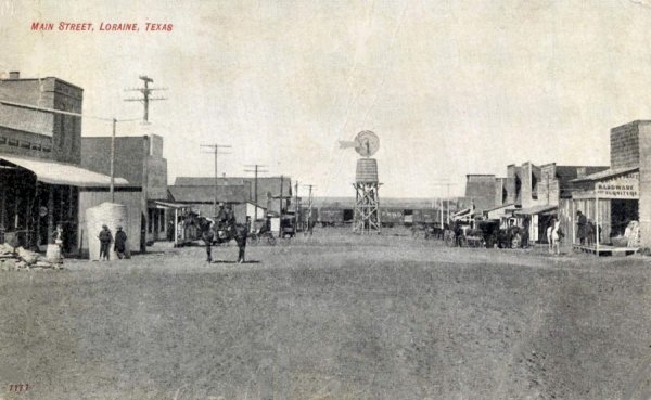 |
Main Street, Loraine, TX dated 1904 Submitted by: Merlyn Bruce |
|
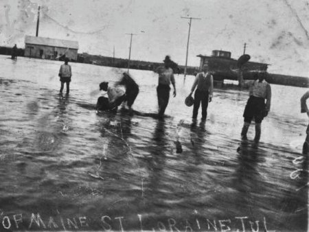
Main Street, Loraine, TX, the Flood of
July, 1909 Jerry found this picture of in his grandparent's photos, who lived in Loraine from 1900-1915 Submitted by: Jerry Brooks |
 |
 |
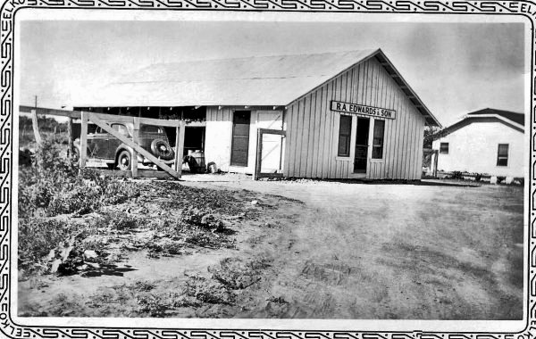
Edwards Lumber Yard Loraine, TX - 1930's Submitted by: David Edwards |
| Tornado in Loraine, TX - Mar 2004 Submitted by: Frances Elliott Godwin |
|
| |
|
Last Updated: | |
|
Copyright © 2007-Palmer - Christina Palmer-The TXGenWeb Project - All Rights Reserved
COPYRIGHT NOTICE: All files on this site are
copyrighted by their creator. They may be linked to but may not be reproduced
electronically or otherwise without specific permission from the county host
and/or the contributor. Although public information is not copyrightable, the
format in which it is presented, the notes and comments, etc., are. It is
however, quite permissible to print or save the files to a personal computer for
personal use only. |