Barnesville
B Cemetery

Barnesville B Cemetery, 10 Sep
1885,"This cemetery is located in the northwest quadrant
of Red River County, Texas. GPS COORDINATES: Datum WGS84: 33
Deg 55.581N, 95 Deg 12.588W. From Woodland take FM 410 north
for 12.8 miles to the intersection with CR 2356. Take CR 2356
south for 6/10 mile south to CR 2355. Take CR 2355 west for 7/10
mile and you are in the cemetery. It is at the northwestern edge
of the Garland Geer Survey. A deed to Barnesville Missionary
Baptist Church from Rev. E. Barnes, Sr., conveys 1 acre of the
John Askey survey, this instrument made on 28 May 1886 and filed
on 29 May 1886, being duly recorded in Book CH Vol 10 Page 288.
This is a black cemetery and the oldest marker was that of Clarsa
Barnes who died 10 Sep 1885. This cemetery was surveyed by Lawrence
and Sue Dale on 21 Feb 1999. While revisiting the site on 24
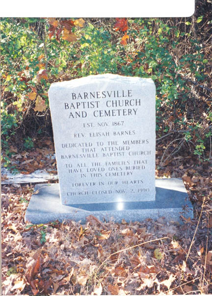
Jan 2000, we found a new site marker as follows: Barnesville
Baptist Church and Cemetery established Nov 1867, Rev. Elisah
Barnes, Dedicated To The Members That Attended Barnesville Baptist
Church, To All The Families That Have Loved Ones Buried In This
Cemetery, Forever In Our Hearts, Church Closed 2 Nov 1990. We
visited the site again on 6 Dec 2003 and took the GPS readings.
We also did a re-walk of the cemetery adding new burials and
noting marker changes."
Go here for some of the names
|


