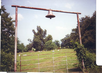
Free
Hope B Cemetery

"Free Hope B","Cemetery","14
Jun 1885","Free Hope B","This cemetery is
located in the northeast quadrant of Red River County, Texas.
GPS COORDINATES: Datum WGS84: 33 Deg 39.395N, 95 Deg 00.533W.
From the intersection of FM 1159 and Hwy 82, take FM 1159 north
for 3.4 miles to the intersection with CR 3202. Turn right or
east onto CR 3202 for 8/10 miles. The cemetery is on the east
side of the road. There is a deed transaction dated 25 Aug 1877
and filed for record on 2 Jan 1886 in Book CH Vol 9 Page 500
for 1 acre of the John Ware survey from William Beaty et ux to
Freehope Methodist Episcopal Church. The oldest marked burial
is that of Selah Becton who died on 14 Jun 1885. This cemetery
was surveyed by Lawrence and Sue Dale on 18 Jan 1999. We were
on site on 8 May 2003 and got the GPS Coordinates. We also did
a re-walk of the cemetery adding new burials and noting marker
changes on 7 Dec 2003."
|

