Centerville, Texas
USGenWeb >> TXGenWeb >> Dallas County >> Towns & Communities >> Centerville, Texas
 |
|
| Latitude | 32.8776251 325239N |
| Longitude | -96.6202714 0963713W |
| Elevation feet/meters |
541/165 |
| Zip Code | |
| Founded | |
| GNIS FID | 1378109 |
| TXGenWeb Site | |
| Cemeteries | |
| Library | |
| Local Genealogy Society | |
| Wikipedia | |
| Tripp | |
Matthew Hayes Nall
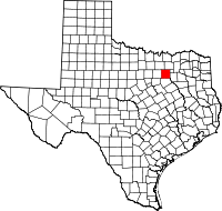
Centerville was on Duck Creek twelve miles northeast of Dallas in eastern Dallas County. The townsite is within what is now the city limits of Garland along Centerville Road between Miller Road to the north and Broadway Road to the southeast. The Eastern Hills Country Club and the western finger of Lake Ray Hubbard are to the east. The community was located on the original land grants of John Little to the east, J. Mills to the north, and J. W. Keen to the south. The site was reportedly settled in the 1850s. It had a school with fifty pupils and one teacher in 1896–97. In 1936 the community reported two businesses, a school district, and a population of ten. By 1940 Centerville had lost one of its businesses. The last available population figure for the community was ten, reported in the 1947–48 Texas Almanac.
BIBLIOGRAPHY: David S. Switzer, It's Our Dallas County (Dallas: Switzer, 1954).
Handbook of Texas Online, Matthew Hayes Nall, "CENTERVILLE, TX (DALLAS COUNTY)"


