Estelle, Texas
USGenWeb >> TXGenWeb >> Dallas County >> Towns & Communities >> Estelle, Texas
 |
|
| Latitude | 32.8662384 325158N |
| Longitude | -97.0130632 0970047W |
| Elevation feet/meters |
548/167 |
| Zip Code | |
| Founded | |
| GNIS FID | 1378271 |
| TXGenWeb Site | |
| Cemeteries | |
| Library | |
| Local Genealogy Society | |
| Wikipedia | |
| Tripp | |
Matthew Hayes Nall
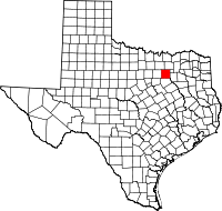
Estelle was on Estelle Creek fourteen miles northwest of Dallas on the western border of Dallas County. It was on the original land grant of H. Burgoon. The site was settled in 1881 as a rural crossroads rest stop on the route between Farmers Branch and Bird's Fort (now Birdville) in Tarrant County. The community was named Estill in honor of an architect from Grapevine; the name was inaccurately recorded in Washington as Estelle. A local post office operated from 1881 until 1904. By 1885 the town had a population of seventy-five, a steam cotton gin, two churches, a school, a blacksmith, two doctors, a teacher, and a reverend. The community was a shipping point for cotton and grain on a stage route to Grapevine and Dallas. The stage ran three times a week. In 1890 Estelle had a population of fifty, a general store, a cotton gin, a physician, a blacksmith, and Presbyterian and Methodist ministers. It supported a school with one teacher and forty-one pupils in 1896–97. By 1930 the community had only one business and a population of thirty-eight, the figure it retained until 1948, the last year Estelle is listed in the Texas Almanac.
BIBLIOGRAPHY: Henry Gannett, A Gazetteer of Texas (U.S. Geological
Survey Bulletin 190, Series F, Washington: GPO, 1902; 2d ed.,
U.S.G.S. Bulletin 224, 1904). Fred Tarpley, Place Names of Northeast
Texas (Commerce: East Texas State University, 1969).
Handbook of Texas Online, Matthew Hayes Nall, "ESTELLE, TX"


